Rain Totals
48-hour period ending 7 p.m. Sunday
• Ramona - 4.10 inches
• Volcan Mountain - 2.69 inches
• Kearny Mesa - 2.39 inches
• Montgomery Field - 2.33 inches
• Palomar Mountain - 2.09 inches
• Miramar Lake - 1.83 inches
• Lindbergh Field - 1.6 inches
• Fashion Valley - 1.5 inches
• Santee - 1.38 inches
• Lake Murray - 1.34 inches
• Poway - 1.31 inches
More rain, higher than average surf and strong rip currents could be possible in San Diego County again Monday, although moisture from the remnants of Hurricane Dolores was decreasing.
Scattered showers and isolated thunderstorms are expected to decrease from the south Monday morning, although there will still be a chance of rain, according to the National Weather Service. Forecasters said much of San Diego County had a 20 percent chance of measurable precipitation.
"Moisture from the remnants of former Hurricane Dolores will decrease the next few days with high temperatures remaining a little below average for inland and a little above average for coastal areas," according to the weather service.
A National Weather Service beach hazards statement was scheduled to expire Monday night. Meteorologists said moderate south swells generated by the storm will affect local beaches through Monday night.
Surf of up to 5 feet is expected, with higher sets along south- and southwest-facing beaches. Forecasters said the chance of more lightning affecting local areas was lower than over the weekend.
Beachgoers were advised to abide by posted warning signs, talk to a lifeguard before swimming and use caution in or near the water.
Weekend weather
According to the National Weather Service, the previous precipitation record for July 18 was set in 1922, when a mere 0.01 inches of rain hit San Diego.
That record was drowned by the 1.03 inches recorded at Lindbergh Field, the wettest July day since data collection in the area began in 1850.
In just one day, the remnants of Hurricane Dolores also made this month the wettest July in the county's history, the National Weather Service said.
Although summer thunderstorms are not uncommon, James Thomas of the weather service said they rarely strike the coast.
"They mostly hit the mountains," Thomas said. "There needs to be a subtropical disturbance in order for these storms to happen in coastal areas."
Thomas said these disturbances only happen about twice every summer. However, they are usually very mild compared to Saturday's magnitude.
He described the recent system as an anomaly, exacerbated by warm temperatures and high pressure brought by Dolores.
This caused San Diego to be thunderstruck repeatedly. In fact, the weather service counted nearly 1,800 lightning events, 528 of which hit the ground.
The lightning disrupted power for more than 14,000 San Diego Gas and Electric customers in the area, primarily within the city limits.
A house was severely damaged by a tree knocked over by the heavy wind and lightning in Tierrasanta. No one was injured, San Diego Fire-Rescue Department said.
Other weather-related damages included floods, mudslides, sinkholes. Total damage costs were not released.
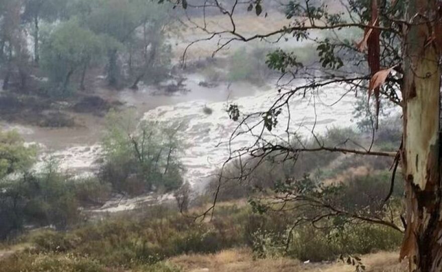
The rain returned full-force on Sunday, even causing flooding in Ramona.
The California Highway Patrol reported that a house was flooded and cars were underwater at 11th Street near State Route 78 in Ramona.
The rainfall added 400-acre feet of water to San Diego's reservoirs, according to the city's Public Utilities Department. The amount can supply water for 800 to 1,100 families a year.


