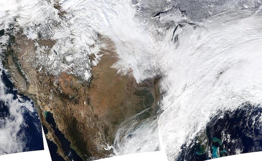

NASA caught our eye earlier today when the space agency tweeted a composite image of the huge winter storm that has covered parts of the Midwest and Eastern U.S. with a deep blanket of snow.
The photos that make up the image were taken Thursday, NASA says, during several passes of its Aqua satellite. The craft used its Moderate Resolution Imaging Spectroradiometer -- MODIS -- "to capture this true-color image of a massive winter storm moving up the eastern seaboard," the agency says.
The gigantic storm is moving into the Atlantic, after leaving snowfall of well over a foot in some areas. As the system moves on, it's being trailed by extremely cold temperatures and high winds that are making the cold even more biting.
"The next storm is forming, and will bring blizzard conditions to the northern Plains Friday Night into Saturday," NASA says. "Extreme wind chills to -55 F are possible in the northern Plains this weekend."
As Mark reported earlier today, the outgoing storm has been blamed for at least 13 deaths, some of them from incidents on the roads. It has also caused more than 2,942 flight cancellations and more than 5,600 delays, according to FlightAware.com.
Copyright 2014 NPR. To see more, visit www.npr.org.


