The images and feel of San Diego going up in flames in 2007 are seared into the memories San Diegans, the blood-tinged sky, the air thick with smoke, ash and panic.
”It was like standing in a hurricane that was on fire,” said San Diego Fire-Rescue Battalion Chief Craig Newell. “I could barely stand up, the wind was so bad. And it was whipping embers right by me sideways.”
In the end, the fires killed 10 people. More than 2,000 buildings and homes were destroyed causing $2 billion in damage. And half a million people had to be evacuated.
To help ensure the region doesn’t see an encore, the San Diego Fire-Rescue Department has created an arsenal of data and technology.
A library of knowledge
The department’s Emerging Technology Manager Mike Scott said the biggest risk to life and property has been in the region’s backcountry. That fact has led experts and fire officials to study the area.
“We went out in normal conditions and tried to identify where are the risks, where are the poor roads,” Scott said. “How is the brush going to behave under Santa Ana wind conditions? If you can go out there and say, `We know this area, Cowles Mountain. We expect the fire, if it started here, would move in this direction and here are the homes at risk. Here’s the critical infrastructure we’ve got to protect,’ then when the real fire happens hopefully we are a little more prepared.”
Fire authorities said they now have a library of knowledge to help them strategize and prioritize their resources.
“We’ve planned pages and pages of information so if the fire comes up this canyon, ‘here’s what we’re going to do,’” Newell said. “‘Here’s how many fire engines we need. Here’s how many helicopters we need. Here’s how many crews we need.’”
Newell said the information, dubbed the Wildland Plans, also contains what are called "evacuation triggers."
“So, if a fire comes down San Clemente Canyon in a wind-driven fire, like we had in the Witch Fire and the Cedar Fire, we know when to start evacuating the neighborhoods so that we allow time for people to make the announcements for people to get out of harm’s way,” he said.
Mobile devices
Newell said the plans have been formatted so that firefighters from other areas can download them on their phones or tablets if they are in San Diego to help with a big fire.
Mobile devices are another big change since 2007.
Newell said fire engine captains out in the field now have smartphones and tablets in addition to PCs inside the fire trucks.
“This allows them to step away from the fire engines and carry with them satellite imagery, mapping technology and connections to these programs in real-time,” Newell said.
It also gives them access to weather apps, a crucial tool for firefighters.
“At one point, the wind may not be to where are our position is but in an hour, it will be and I don’t want to be out in front of it if it’s going to hit us,” Newell said.

Sensor technology on winged aircraft
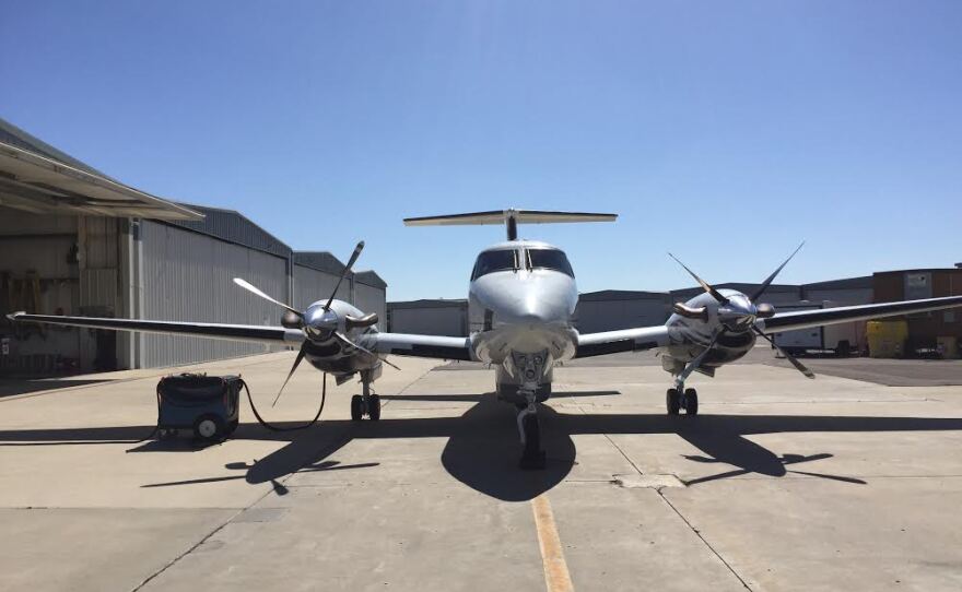
And there’s more. San Diego firefighters will now have access to General Atomics’ sensor technology on winged aircraft known as the King Air 200 turboprop. The technology can spot objects 40 kilometers away.
The technology has previously only been available to people fighting wars, according to General Atomics Aeronautical System's Chief Executive Officer Linden Blue.
“The sensor payloads that we’re talking about are on the one hand video payloads based on optical wavelengths that you can see with your eyes, then different infrared wavelengths which you can’t see with your eyes but they can see through the smoke pretty well and see in the dark and you also have ground imaging radar capability which can see through also pretty much anything,” Blue said at a press conference in August.
General Atomics Communications Manager Chris Wright said the technology will also better help firefighters map out the perimeter of fires.
“The goal is to be able to spot a fire faster, to put it out faster to help the firefighter be more effective because he’s got the best information,” Wright said.
With all of this new technology, are the days of colossal fires on the scale of 2007 over in San Diego County?
Battalion Chief Craig Newell said not so much.
“Because what we’re fighting is a battle of Mother Nature on two fronts,” Newell said. “One is the accumulation of fuels on the ground and they’re drying because of the drought. And the other part is the wind or the weather that’s driving the fire.”


