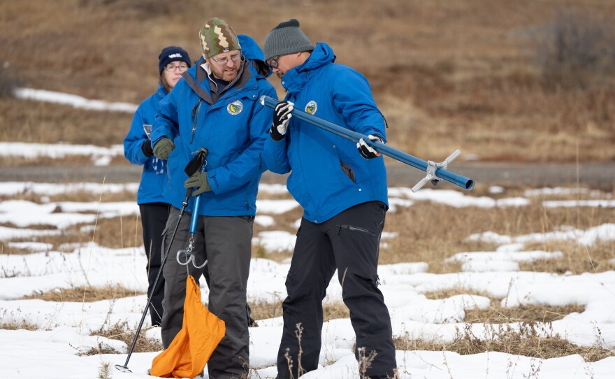
California’s first snowpack measurement of 2024 is underwhelming with levels well below normal for this time of year.
It is quite a change from a year ago when Phillips Station near Lake Tahoe was buried under 4 1/2 feet of snow.
This year there were brown patches poking through the snow as the meager snowpack failed to completely cover the ground.
The station is one of several locations where officials measure snow to estimate how much water is stored there.
“The survey today recorded a snow depth of seven and a half inches and a snow water content of three inches,” said Sean de Guzman, chief of the California Department of Water Resources snow surveys. “That results in 30% of average to date. And 12% of the April average here at this location.”
Phillips Station is one of several locations measured several times each year to gauge how much water is being stored in the snow.
California’s snowpack began the last calendar year 162% above average, and it climbed to 232% above average just two weeks later.
“Today’s result shows that it’s really too early to determine what kind of year we’ll have in terms of wet or dry,” de Guzman said. “And there can be so many things that happen with our storm systems between now and April when we should see our peak snowpack.”
The first of the big three precipitation months — December, January, and February — passed with an underwhelming impact on the Sierra snowpack.
Last year, California already had two atmospheric river storms by this time, and that was enough to pile-up record snow levels. This year, not so much.
“Along the coast, we’ve had some wet weather, some extremes, but really in the interior, not as much,” said Michael Anderson, a climatologist at the California Department of Water Resources.

A couple of cold storm systems this week could be a boost for the Sierra snowpack pushing up the depth of the snow.
But the drier-than-normal conditions have become more frequent than not.
“In fact, precipitation is lean across the whole landscape, not only the mountainous cooler part, but the warmer part,” said Dan Cayan, a climate researcher at UC San Diego’s Scripps Institution of Oceanography.
Cayan said warmer planetary temperatures will also warm the storms that bring precipitation to California.
“If these storms are warm enough, the rain actually carries heat,” Cayan said.
Rain falling on snow could fuel flooding and reduce the amount of water being stored in the mountains for the critical spring and summer when snow melt feeds thirsty cities and towns.
Roughly one-third of California's water supply comes from melting snow in the Northern California mountains.
The watersheds north of Sacramento account for about 75% of California's rain and snow. But about 80% of the demand for water centers on southern California, where most of the state’s people live.
Federal climate forecasters say the water level in the state’s reservoirs is currently about 116% above average.
The next snowpack measurement happens in early February. The size of the snowpack is typically highest in April.


