This is KPBS Midday Edition. I am Maureen Cavanaugh. The fires raging northern California and the Pacific Northwest have been burning for weeks. Hightemperatures Radic wins although humidity along with drought conditions have been hindering efforts to control the fires. But even something as difficult as fighting a wildfire is getting some meaningful help from technology. At the Visualization Center at San Diego state University researchers are experimenting with a device called a Simtable that could revolutionize firefighting strategies. Over the sensor network setup in San Diego's backcountry will allow meteorologist to monitor and rate the strength of Santa Anna winds. Joining me are Eric Frost, Director of San Diego State University's Visualization Center and Eric, welcome to the programs and its will delight and privilege to be here. Steve Vanderburg also George's, he's a senior meteorologist with San Diego gas and electric and state, welcome to the show. Thank you for having me back. Eric, the Simtable is a simulation device this continues for a while. Canyou describe how it combines a sand terrain simulator with new technology? Sure. It is actually a very simple way it is really how do you help understand something and your mind so it is not really a device, it is really Julie a way of displaying information. The classic think that military people have done for thousands of years if he makes in the model in the ground then you actually can see what can you see, what can you not see in related to fire or even Al Niño a powerful thing is fire behaves has often has a very profound effect is affected by terrain. The fire races up or runs up the mountain, that speed, the change, and relationship with the wind that SDG&E is measuring in such a profound way enables you to see to have it animated and actually the cloud computing is measuring it doing what is the topography, what is the when, what is the fire fuel load and then gives you a solution that you can actually watch it. A simple way of saying it would be 100 some years ago people took a picture with the photograph that was a still picture, now when we go to the movies we use the movie is things move and you actually understand movement and with fire as something moves especially if it moves you need to get out of here, the road is going to be bought, it is going to be burned over, you're going to be dead unless you do this and for somebody who is a fire leader absolutely the fact that you can see something you can make a decision especially in terrain that you are not familiar with, you can say look what's going on, here are in the sense that a composite of all of the sensors on information put them together and you then have an animation that you actually conceived and make a decision and the last thing you can also drop social media on top of that. It is like a 3-D animation and it is remarkable in the sense that you put a laser at a certain place and that would initiate the fire, it would be a replicating where the fire started and then putting in the data that you have about humidity and wind speed and temperature and terrain and so forth. Then you see how actually how a model of how the fire would grow. That's right in you can also go backwards and get the real data and duplicate a fire like you are -- or 90 firefighters were 19 firefighters die when you watch that you can go you actually see what happened. This is a tool that's been a profound way the change of animation incentive but we have classically looked at as a line, fire perimeter that has become the way the fires are shown and we made that Richard transition back in 2007 and in a powerful way KPBS med next word and your contribution of was the very first time buyers crossed the US-Mexico border. Fires cause the border but jurisdictional you, we had never had done that and KPBS with Google Earth made that nature way of looking at fire actually does cross the border and had huge applications and this way and now that sense of it moving it isn't now just a line, I perimeter lie, it is now you see how it can raise up the side of the Hill and the entire set up the Hill can be on fire that it may have moved 40, 50, 60 miles an hour and another part didn't move. So you see the very heterogeneous motion so when you try to get that in your mind and when you look at the SDG&E fire with the wind, the numbers are notall the same. And you cannot mentally do that but the cloud computing can actually do that and you, look at it and perhaps the most powerful think use of the CAMECA QR code of what you are looking at, capture it on a smartphone, put it on YouTube and millions of people, get it and it is amazingly something that the County of San Diego can afford because it is free. How we live -- any pushed information forward in time? The thing that would make that the most powerful would be this collaboration with SDG&E because if you have the pattern through time the pattern to time would be when the wind blows from offshore, onshore, does that you are the oldest time and it switches that's a pattern we see over and over again. By just looking back on that pattern the pattern that SDG&E can make would be in the sense it would be they now have the narrative for what happens. Then you can look at forward in the book instead of just reading it look forward for four hours and you say this afternoon the fire is going to change because the wind is going to change that now becomes SDG&E innocent saving the day because they had the information, the intelligence of what's going to happen in the future. The information is there, but information that you cannot use is just information. Let me go to Steve Vanderburg because we had you on last year when the new wildfire weather center network just went up, it was brand-new. Refresh our memory on that if you would. It is wildfire weather center network setup in San Diego's backcountry, where are the sensors and what do they measure? We have are pretty dense, exact one of the densest networks of weather stations of the country it is really one of the most sophisticated. There's over 170 plus weather stations those three in the backcountry but we do have that network extending toward the coast because we know there our areas along the coast where we are concerned about wildfire. We found that in May of last year and these stations provide us with wind speed, wind direction, and juror, humidity, you name it, every 10 minutes across the entire county. That gives us a level of situational awareness and visibility that we have never had before. SDG&E sponsors this network, how closely do interact with the National Weather Service? We interact closely with the weather service and frequently. Is you may know, I work for the weather service here in San Diego for many years before I joined SDG&E so I know a number of the people who work there and we share all of our weather data including not just from our weather stations but we have atmospheric profilers I give us some pretty detailed information about what is going on above our heads. That information goes to the weather service. We worked on a project with US Forest Service to -- which we will talk about a few minutes but all that data is publicly available even our forecast models, we have some cutting edge high resolution weather forecast models that we are running on a daily basis at SDG&E and we sure that data as well. With the National Weather Service. We do have a very close working relationship with them. I do want to talk about the fact that you have developed a category system for sent and the events as we would see in hurricane situation or tornado. Tell us about that. Just like you said, historically when we have had periods of strong Santa Ana winds and high fire danger the National Weather Service would issue a red flag warning and we all know what that means that there's the potential for large fires. What we did have was a way to separate out all the events where we could say this one is your average bad Santa Ana wind fire day but this one is your worst-case scenario like and October 20s -- 2007. In a way that hurricane gets rated cap want to cap five what we were lacking here was a similar system that could rate the intensity of the fire danger so describe associated with a Santa Ana wind event so we embarked on a multi your project with the US Forest Service suspect with a meteorologist to work at the addictive services up in Riverside to help who provide the weather support to the fire agencies and also you UCLA, the National Weather Service Cal fire and others and we basically really pushed the science of fire weather. We look very closely at the vegetation, the live plants, the difference, what's the grass three, we looked at all the weather information that we have clicked from our weather stations and we created a 30 year historical database that takes all of these factors, vegetation dryness, the Queen's of the grass, the weather conditions combined to in the way that that spits out a single number which represents what's the potential for large fire and once all that was done we basically correlated that twist Oracle fire current and then developed the breakpoints so there's a lot of science behind it but then ultimately we created a very simple tool that can be communicated easily to the public that basically rates the potential for fires with each event on a scale from one dual to extreme. I see so it is not necessarily one, two, and three, he comes with a name attached with marginal, extreme, what are the other categories between those two? Marginal would be our lowest rate, decimated what is low it is like a category one hurricane, it still a major threat but then it goes to moderate, high and extreme and for each of those ratings there are actions that are listed with them that you can find on Santa Ana wildfire threat.com, that's with the forecasted is available also where all the actions that you should take to prepare for such an event are listed as will as links to other resources so for instance here in San Diego County a great resource is ready San Diego.work and they have a fantastic app which by the way in addition to communicating all these warnings and fire information Zamefa warnings they also push out the Santa Anna Wilde fire index reading, it is not just a rating system it is here's how bad it can be and here's what you need to do to prepare. Eric Frost, as I said in the beginning the Simtable is something that has been used, it wasn't developed at STS you, I believe it was dropped in New Mexico and you guys at the Visualization Center are working with that. What kind of research are you actually doing with this tool? Thank you. One of the major think so things that we're really interested in our how to help firefighters because they are a group of people that are incredibly courageous that are out doing something oftentimes they have no idea of what the setting is that around them. A bit of an example is that every day NASA takes an image of every part of the world so there is a new NASA data sets into -- at the complete picture of an damaging of the world every day. The several others like [Indiscernible] that are taken that are, is for [Indiscernible], we are looking at can you actually take the image that's been taken and compute the fire fuel load so the cap it in real time or that they. We are also looking at how you would do for one of the things that moves on typography as well that you do not see his carbon monoxide. Carbon monoxide is one thinks that there's almost no instrumentation that's taken place over low wildfires to look at the pattern firefighters and that can very much be the sense of the loss of cognition, the supercharged feelings ways the ways you are making the wrong decisions and -- maybe next about that. So when you actually look at how you would help firefighters by you would also help planning so how would somebody in Ramona when they were looking at the floods that just hit them, things that fire and flood sort of the same thing with her it is going up or going down stomach Simtable also stimulates blood conditions? Yes, say if you did love condition of as one classic sample for San Diego in 1916 when the floods hit the backcountry came down and -- nobody had a good water was coming down and they were going to die. From the same thing where the weather would take place in the backcountry of how the canyon strained a in a special with the canyon strain into Mexico and he comes back out same Ysidro both -- those are things you cannot put in your mind so some of the things that we're doing is how do you both understand what's happening come how do you then set up the alert alerting, how do we get to social media, how do you also link it to things like quad copters and with social media we are very deeply involved in the geospatial use of social media and I would also the point of ready San Diego. That's actually a next ordinary resource that you could say for San Diego teeone, with several million people here I think when you ready San Diego has 14,000 followers. So you can go into buddy list into a favor to followed it would double and we are pathetically unprepared because people have not gone out and gotten ready and something as simple as Twitter is there and available but we do not use it. We do not take advantage of what people have built. Eric, how do you see the information with the Simtable tool being able to be dispersed and understood by people getting it on social media? That's great question. It is one of the huge power of what Stevie jury and developer of Simtable has done where when you look at social media right now the extraordinary think people are interested in are the pictures are look at a picture, people are take pictures of the fire, the pictures are taken from different places. Those pictures can be combined with computing to give you -- three-dimensional model that can then be also been sent out a survey not just looking at a flat picture you looking at the three-dimensional model of what is there and that now is a way that the Simtable is a joining together of the Smartphone all of the extraordinary capabilities it has as a computer taking a picture via social media and throwing that into the visualization so now what you are looking at is it is functioning an aggregator to this massive amount of data that is there some ethical would be instead of when we reach the 2007 about the highest and what was that there were by the incredible work of the GIS people in the county was a map every four hours as they try to put all the stuff together for radios. Now we actually have the pictures and with those pictures you can actually now put together something that you can make an animation of the moving of the fire and stereoscopic treaty and probably put a new version out every five minutes and that actually could help. I am wondering just listening to Eric Steve, do you see this technology actually helping what you do with the wind speed and developing the designation for the kind of sent an event is going to be? Visualization is so important for communicating your message whether it be for communicating a threat of what's coming or what is happening on the ground as a meteorologist, it is funny, I can give a forecast to 50 different people in the room and asked them what they heard and they are all going to tell me 50 different things, but a picture doesn't live so I think that's the value of tools such as this is what you are able to visually communicate what is going on there is less room for misinterpretation which in and of itself makes the situation much better because now everybody is on the same page and we know where we are going with this. I wish I could talk about this much longer, it is fascinating, I've been speaking with Eric Frost of SDSU Visualization Center, Steve Vanderburg, senior meteorologist with SDG&E, thank you both very much. Thank you. Thank you.
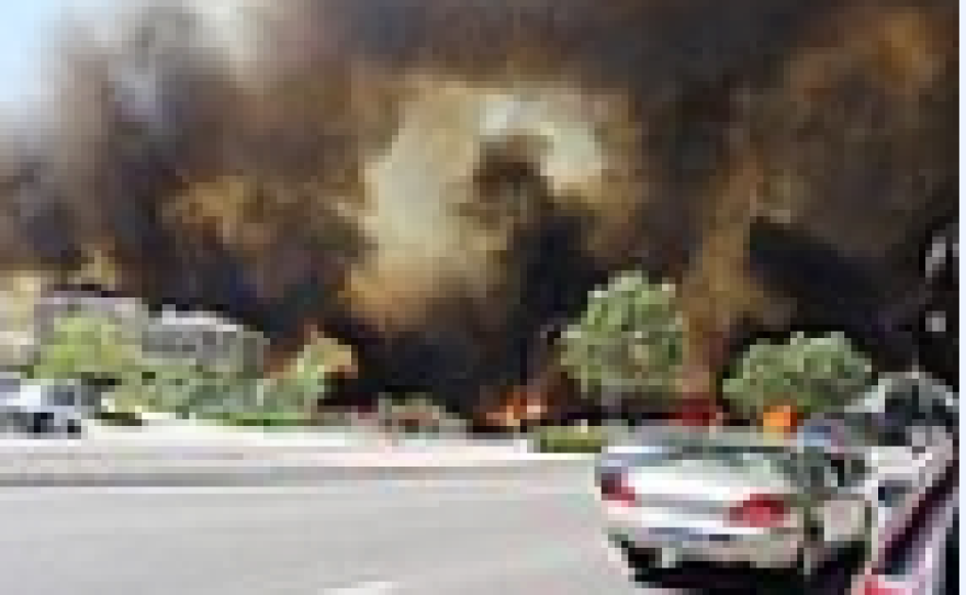
More than 11,000 firefighters continue to battle wildfires in Northern California and in the Pacific Northwest. San Diego County has seen its share of devastating wildfires — but as we head into our fire season, there's new technology being studied by local researchers that may better determine wildfire behavior.
The Simtable is a box of sand that can be shaped into 3D topography of a specific area projecting a model mapping a wildfire. While the technology has been used by the military for some time, researchers at San Diego State University's Visualization Center are experimenting with its use in firefighting. Using wind, speed, direction, slope fuels and terrain, a computer simulation determines the progression of a wildfire onto the sand.
"In a very simple way how do you understand something in your mind," Eric Frost, director of the Viz Center, told KPBS Midday Edition on Monday. "It's a way of displaying information."
San Diego Gas & Electric has also created a system to help with battling wildfires.
Steve Vanderburg, senior meteorologist with SDG&E, said the company has developed a tool to gauge how bad Santa Ana winds can be.
Vanderburg said they studied 30 years worth of Santa Anas and developed a category system to rate future Santa Ana winds.
The new system rates future Santa Winds from a scale of "marginal danger" to "extreme danger," Vanderburg said.
"We really pushed the science of fire weather," Vanderburg said. "We created a very simple tool that can be conveyed to the public."


