The last time a strong El Niño pounded San Diego County, nearly two decades ago, rainfall averaged 188 percent of normal, triggering floods, mudflows and coastal erosion.
Now, San Diego is bracing for a potential repeat event, though no two El Niños in the record books have been exactly alike, said Dan Cayan, a climate researcher at USGS and Scripps Institution of Oceanography.
“This El Niño looks really robust and it’s strong, but not with the extreme amplitude we saw in 1997,” Cayan said.
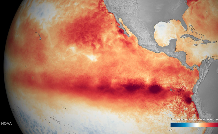
The latest report from the National Oceanic Atmospheric Administration shows El Niño is strengthening and on track to become one of the most powerful on record. Water temperatures in the equatorial Pacific Ocean are nearly 4 degrees Fahrenheit above average. The unpredictable condition is expected to play havoc on weather systems across the globe through spring.
El Niño’s wrath this fall and winter in San Diego could once again lead to flooding and mudflows.

“In several of the large El Niños, not all of them, storminess was more frequent and in some cases more intense,” Cayan said.
Four years of severe drought have left hillsides parched, the ground rock hard. An inundation of rain would cause problems, Cayan warned.
“If you get a large event where there’s a lot of rain in a short amount of time then that water’s got to go somewhere,” he said.
Like the 8 inches that dumped on San Diego during February 1998, flooding streets, rivers and low-lying areas.
Then there’s mudflows. Cayan said it would likely take several rain events for the drought-riddled soil to reach saturation.
“It’s when we get that near-saturation condition and we generate lots of runoff, usually during intense rainfall — that’s when we get a lot of damage," Cayan said.
Ocean coastal erosion is another major concern — especially if storms coincide with high tides. That’s what happened during the strong El Niño in January 1983. Many locations along the coast reached their highest sea levels on record, Cayan said.

“That’s because we had, first of all, high astronomical tides,” Cayan said. “We had an El Niño effect which tends to elevate the water levels along this coast between 6 and 12 inches above its normal stand, and then we had big storms, large waves.”
El Niños can generate large wind waves from distant North Pacific sources as well as local generation, as storms move on shore, Cayan added.
In 1983, large waves destroyed dozens of restaurants, homes and other structures, including the Scripps Pier. Damage across the state topped $1 billion.
Cayan said coastal damage during the 1998 Niño was less severe.
"In ’98, we had equally active storms during that winter but we kind of dodged a bullet because those storms happened not to coincide with the highest tides,” Cayan said.
Emergency officials are hoping to dodge another bullet with the coming El Niño. Still, they’re preparing for the worst.
“It’s a very interesting time here at the Office of Emergency Services,” said Director Holly Crawford. “We are planning all at once for drought, for flooding and for fire.”
Crawford is working with emergency officials and leaders across the county to plan for El Niño and its potential disasters.
“Our areas of concern are definitely the recent fire burn areas as well as residents who live near streams, residents who live on any type of sloped property,” Crawford said.
Part of her planning includes a public outreach campaign to inform people how to stay safe. She said it’s essential that people know their flood risks and take action now to prevent runoff from reaching their homes.
The county is offering free sandbags at nine locations for residents who live in the unincorporated area of the county.
Crawford said during an emergency, communication is key. People can follow ReadySanDiego on Facebook and Twitter.
“You also want to make sure that you register your mobile phone with Alert San Diego. That’s the county’s mass notification system,” Crawford said.
If conditions continue on track, El Niño-fueled rains could begin falling in San Diego as early as next month, though there are no guarantees.
"We're hoping that the first rains from this forecasted El Niño show up before the Santa Anas come through this fall," Crawford added.


