Updated at 8:19 a.m. ET
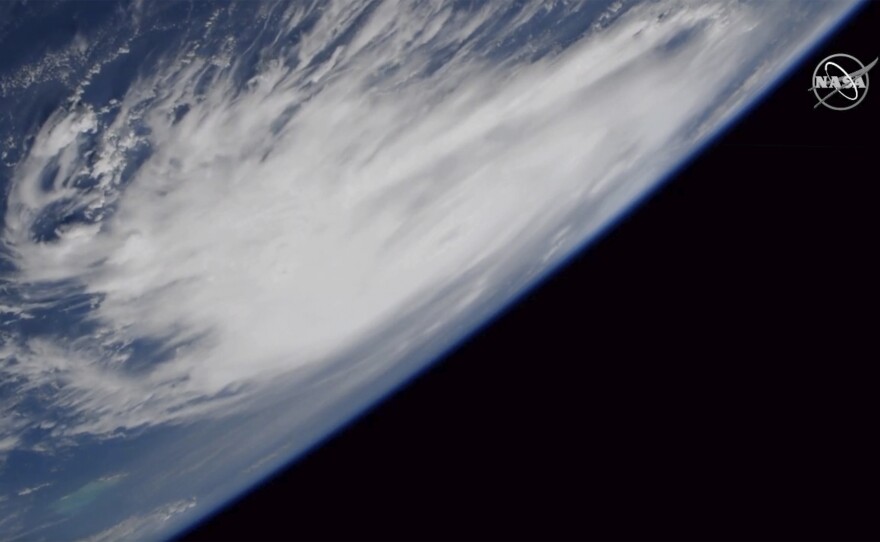
Hurricane Dorian has grown even more powerful, strengthening to a Category 5 storm as it approaches the Bahamas with what the National Hurricane Center warned would be "devastating winds" and "life-threatening storm surge."
Maximum sustained winds for Dorian increased to near 160 mph, according to the NHC. The storm's projected path shifted east on Saturday, increasing the likelihood that the storm will make landfall in Georgia and the Carolinas. And while Florida may now avoid a direct hit, the storm could still bring a dangerous storm surge and hurricane-force winds to the U.S. mainland.
Once it reaches the Bahamas, the storm is expected to linger for up to 24 hours, bringing massive rain, and a 20-foot storm surge posing catastrophic damage to the low-lying islands.
On Saturday afternoon, Ken Graham, director of the NHC, said the storm is slowing down as it prepares to turn north.
"We have a movement of about 2 miles an hour during that turn. That's devastating for the Bahamas," Graham said. "When you're moving that slow, that's a lot of rain, that's a lot of prolonged winds. That is really devastating for some of the islands in the northern Bahamas."
As much as 64 inches of rain could fall over the northern Bahamas once Dorian reaches the archipelago, according to storm models.
Meterologist Ryan Maue says that the current forecast track for the Bahamas "is a disaster: feet of Rain, storm surge, and Cat 4 sustained winds."
Bahamas' Prime Minister Hubert Minnis urged residents in the path of the storm to evacuate. Officials have opened nine hurricane shelters on Grand Bahama Island and 15 shelters on Abaco for people to stay during the hurricane.
In a post on Facebook, the NHC wrote that the storm continues to track west as it approaches the Bahamas:
"Hurricane Dorian is centered as of 11 a.m. EDT about 415 miles (670 km) east of West Palm Beach, Florida. Dorian is moving toward the west near 8 mph (13 km/h) and a slower westward motion should continue into early next week. On this track, the core of Dorian should move over the Atlantic well north of the southeastern and central Bahamas today, be near or over the northwestern Bahamas on Sunday, and move near the Florida east coast late Monday through Tuesday."
The National Weather Service says tropical force winds are expected to arrive in parts of south and central Florida as early as Sunday or Monday. The storm is then expected to affect Georgia and the Carolinas in the middle of next week.
Dorian is expected to bring between four and eight inches of rain, and in some isolated areas, up to 12 inches of rain to the southeast United States, according to the NHC.
In Florida, Gov. Ron DeSantis expanded a state of emergency to include each of the state's 67 counties, citing the storm's "uncertain path." President Trump has also granted DeSantis' request for an emergency declaration in Florida, authorizing the Federal Emergency Management Agency to provide equipment and resources to the state.
Despite the shift in the storm's projected path, DeSantis urged residents on Saturday to be prepared.
"Although the path of #Dorian has shifted, the entire East Coast is still vulnerable to significant impacts. Residents in East Coast counties should continue to monitor local reports and stay vigilant," DeSantis said on Twitter.
Georgia Gov. Brian Kemp has declared a state of emergency in 12 counties.
North Carolina Gov. Roy Cooper declared a state of emergency on Friday. On Saturday, so too did South Carolina Gov. Henry McMaster.
"Given the strength and unpredictability of the storm, we must prepare for every possible scenario," said McMaster. "We encourage all South Carolinians who may be impacted by Hurricane Dorian to be vigilant and prepare now – there is no reason for delay."
Slow-moving storms like Dorian are getting more common as the Earth gets hotter. In the past 70 years, tropical cyclones around the world have slowed down 10 percent, according to a study published earlier this year. Hurricanes Florence, in 2018, and Harvey, in 2017, were both slow-moving storms.
When storms move slowly, they have time to drop a lot of rain. Warm ocean water also exacerbates the risk of extreme downpours. After Hurricane Harvey hit Texas, researchers found that record-high temperatures in the Gulf of Mexico sent enormous quantities of water vapor into the storm, which then fell as rain when it made landfall.
This year the surface temperature of the water in the Atlantic, where Dorian formed, isn't record-breaking, but the water is still warmer than the past average. That means there's plenty of fuel for the storm to get large and wet.
Copyright 2019 NPR. To see more, visit https://www.npr.org.


