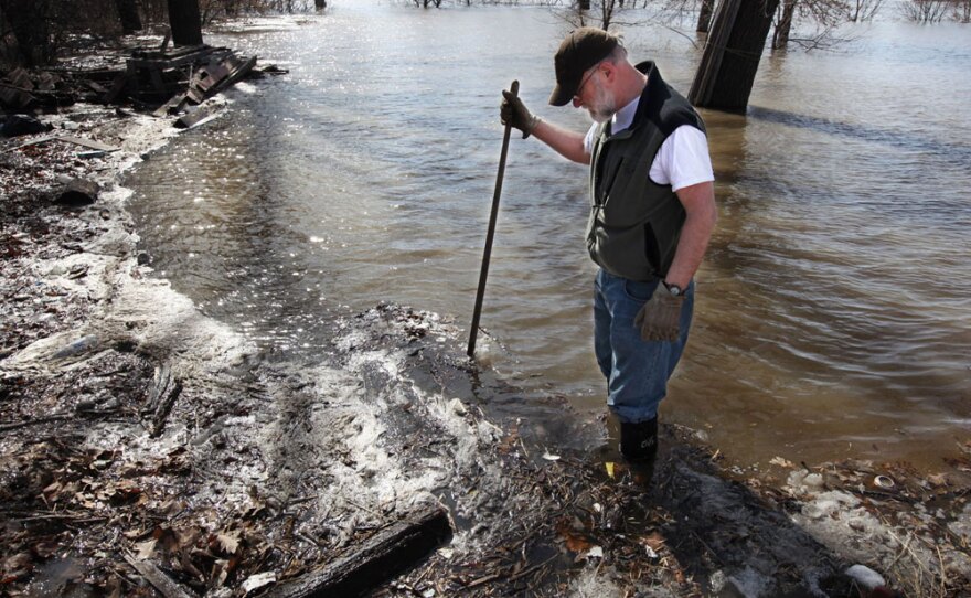
Residents in St. Paul, Minn., kept a watchful eye on the swollen Mississippi River on Thursday, as rapidly thawing winter snows and new precipitation threatened to swamp the city with a history-making flood.
Throughout the Red River Valley, officials and homeowners raced to build levees and lay sandbags as the Mississippi, Red and St. Croix rivers began to overflow their banks in some places. Many roads in the region were closed due to high water, and Minnesota Gov. Tim Pawlenty deployed 300 National Guard members to help vulnerable communities prepare.
The Mississippi River was at nearly 12 feet in St. Paul as of Thursday afternoon, and the National Weather Service predicted it would hit the 14-foot flood stage sometime Friday. The weather service considers 17 feet a major flood in the St. Paul area.
"The National Weather Service contacted us and told us that our expected forecast, which had been at 17 feet, is being raised to 18 feet," said St. Paul Emergency Management Director Rick Larkin. "If we go to an 18- or 19-foot crest, that would put 2010 into a top 10 event in the city of St. Paul. The flood of record is still the 1965 flood, and that was over 26 feet."
St. Paul Mayor Chris Coleman declared a local emergency on Wednesday.
In the Minnesota towns of Stillwater — across the St. Croix River from Wisconsin — and Delano, the downtown business districts were flooded, and some roads were already closed.
The National Weather Service predicted that light rain or snow forecast for Thursday night would further swell the region's rivers. Meteorologists said the waterways would continue to rise over the next week as temperatures warm and winter snows melt. Ice jams are expected to cause minor flooding in parts of Minnesota and Wisconsin for several days.
In Fargo, N.D., the Red River was at 33.73 feet by 1 p.m. Thursday. Flood preparations were in their final stages after volunteers and city employees spent days slinging sandbags and digging levees. Weary homeowners were waiting for the river to crest this weekend, as up to 350 National Guard members stood by with emergency equipment.
Volunteers in Fargo — including many schoolchildren — filled their last sandbag on Wednesday after meeting their goal of bagging and placing 1 million bags in vulnerable areas around the city.
Dump trucks carrying clay were still rolling into Fargo on Thursday, as volunteers and city employees turned their attention to extending levees in hopes of blocking floodwaters.
"We're in really great shape," Cass County administrator Bonnie Johnson told The Forum of Fargo-Moorhead, a regional newspaper. "We're almost done with all of the building of the clay levees. ... Sandbags are all out, and we've had a ton of volunteers."
Last year, about 100 homes were damaged around Fargo and Moorhead, Minn., and thousands were forced to flee when the river rose above flood levels and stayed there for 61 days. The devastation was so great that the number of North Dakota residents who had flood insurance has more than tripled since last spring.
Cass County, where Fargo is located, has been buying flood-prone properties through a Federal Emergency Management Agency program. Dozens of homes are on the list and will be demolished after this year's floodwaters recede, according to The Forum.
City spokeswoman Karena Carlson said Fargo has spent $7.4 million buying 25 homes in low-lying neighborhoods since last year's flood. She said an additional seven homes are expected to be purchased by the time the river crests.
The buyouts, which are funded with city sales tax money, have ranged from $69,000 to $1.1 million, the latter of which was for a home owned by James and Margo McCulley.
James McCulley, a retired orthodontist, said his family didn't have a choice. They had to leave because the home was in the path of a planned permanent floodwall. The couple moved this month to another house on higher ground several miles away.
"It was my dream house," Margo McCulley said. "But it was just a house. Wherever we live is our home."
Although the wetter-than-normal spring was causing havoc in the Midwest, it was welcome in the Southwest, where a lengthy drought has left riverbeds dry.
The Phoenix area received as much rain in the first two months of 2010 as it usually gets over a seven-month period. Riverbeds that are typically dry through most of the spring are filling and may deepen as snow melts in the mountains, and empties into rivers and reservoirs that provide the region with drinking water.
However, some of the reservoirs that are typically used for storage are already full, meaning utility companies have to let the water run downstream and eventually into the Colorado River, instead of capturing it for later use.
The wet spring is the result of the weather pattern known as El Nino, which causes warmer sea surface temperatures.
Mark Moran from member station KJZZ contributed to this report, which also includes material from The Associated Press.
Copyright 2022 NPR. To see more, visit https://www.npr.org. 9(MDAzMjM2NDYzMDEyMzc1Njk5NjAxNzY3OQ001))


