In Vermont, people affected by floods in recent years are now wishing they could be included on the Federal Emergency Management Agency's flood maps.
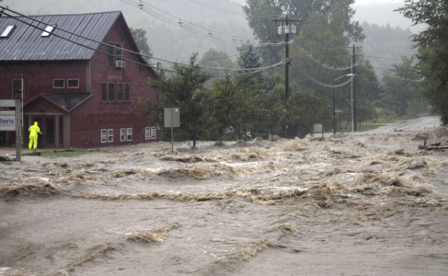
The maps for the state are old and don't include flooding from fast rising rivers and streams, the kind of flooding that tore up Vermont during Hurricane Irene.
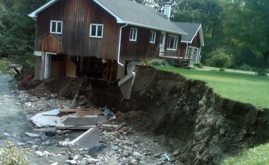
Karin Hardy's house, built in 1850, once stood in Jamaica, Vt., across from the tranquil Ball Mountain Brook. But when Tropical Storm Irene hit in August 2011, she heard boulders tumbling
"The brook was really getting full and it had an energy about it that made me uncomfortable, but I had no idea what was in store," Hardy says.
Hardy left her house without even packing a bag. After all, the house had stood there for well over a century. But the floodwaters charged downstream, plucking her house whole, hurling it against a bridge. Three of her neighbors also lost their homes
The neighbors applied for a FEMA program that buys flood-damaged property in order to reduce future flood hazards. But FEMA determined these properties, and six others in Vermont, are not eligible for the program, in part, because they're not located in a "Special Flood Hazard Areas" on National Flood maps.
These areas are where FEMA predicts there is a 1 percent chance every year that a flood of a certain size will occur. The maps, however, don't predict all floods, even the largest ones, including Irene.
Ned Swanberg, Vermont's Flood Hazard Mapping Coordinator, says FEMA maps focus on what's known as "flood inundation," when floodwater sits and soaks things. But he says that's not the big problem in the hilly terrain of Vermont.
"A lot of the damage that's experienced is from the power of the moving water, the power of the moving sediment and the culverts and roads and bridges and structures that are in the way," Swanberg says.
The state has asked FEMA to include this type of flooding, from river erosion, on flood maps. Another problem is the maps are decades old.
"Right now, we have not made any particular changes in those small, river floodplains in a lot of New England," says Michael Goetz, who recently retired from managing FEMA's mapping program for New England. "And that's not only Vermont, but it's throughout New England."
FEMA's mapping budget this year was cut in half, and there are new priorities as well.
"Congress recently told us that we need to focus most of our attention on mapping all of the populated coastline in the United States," Goetz says.
Not exactly a description of Vermont. Rep. Peter Welch says he's been advocating for FEMA to fix the maps.
"These maps are out of date and they're inaccurate," Welch says. "So that when a flood occurs, if you're not designated in a flood zone, you are out of luck when it comes to FEMA aid."
Without FEMA's funding, the state of Vermont has come up with a plan to buy out the Jamaica properties, and the state is planning for future floods by encouraging building restrictions close to rivers.
Copyright 2013 NPR. To see more, visit www.npr.org.


