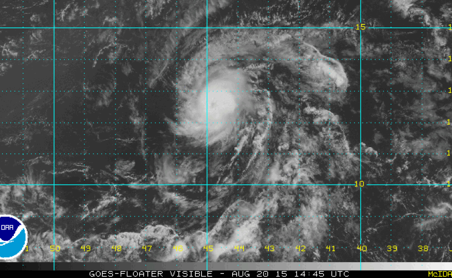
It's official. Tropical Storm Danny has made the leap, becoming the first hurricane of the Atlantic season as it makes its way toward the eastern Caribbean.
Currently, the storm is centered about 1,200 miles east of the Lesser Antilles and moving west at 10 mph. The National Hurricane Center's "forecast cone" has Hurricane Danny making landfall possibly as far north as Puerto Rico or as far south as St. Lucia.
The storm currently has sustained winds of nearly 75 mph, with higher gusts.
In a bulletin, the NHC says: "Danny is a small tropical cyclone. Hurricane-force winds only extend outward up to 10 miles (20 km) from the center and tropical-storm-force winds extend outward up to 60 miles (95 km)."
In a subsequent bulletin, the center notes that the compact size of the storm "makes it subject to significant fluctuations in strength, both up and down, and such fluctuations are notoriously difficult to forecast."
Brian McNoldy, who works in cyclone research for the University of Miami's Rosenthiel School of Marine and Atmospheric Science, writes for The Washington Post:
"The ECMWF [forecast model] favors a weak storm that stays south, while the GFS [model] is generally stronger and farther north, on average. ... "Given what we know now, it is still far too uncertain for anyone beyond the Leeward Islands to be on alert for Danny. The storm won't reach the Leeward Islands for another four days, and a lot can change in the meantime."
Copyright 2015 NPR. To see more, visit http://www.npr.org/.


