Updated October 24, 2021 at 10:03 PM ET
SAN FRANCISCO — A powerful storm referred to as a "bomb cyclone" and "atmospheric river" walloped Northern California late Sunday into Monday morning, causing flooding, power outages and mudslides.
Drenching showers and strong winds accompanied the weekend's arrival of the atmospheric river — a long and wide plume of moisture pulled in from the Pacific Ocean.
The storm soaking the Bay Area on Sunday was tied as the third-strongest since 1950 on the Bay Area Storm Index, and the strongest in 26 years, according to the San Francisco Chronicle.
The utility company, PG&E, reported that at the height of the storm approximately 380,000 customers lost power — about 7% of the utility's 5.5 million electric customers. As of 6 p.m. Sunday, power was restored for approximately 250,000 customers.
The company said residents in the greater Bay Area with San Mateo, Santa Clara and Marin counties were the heaviest impacted by the storm and power outages.
By early Monday, Californians were not out of the woods. The National Weather Service reported the atmospheric river storm will continue to produce multiple hours of heavy rainfall at least through the day.
Heavy rain overnight Sunday is expected to exacerbate runoff in areas in Northern California that have been hit with wildfires, causing even more destructive landslides.
Burn areas remain a concern for officials, as land devoid of vegetation can't soak up heavy rainfall as quickly, increasing the likelihood of flash flooding.
"If you are in the vicinity of a recent burn scar and haven't already, prepare now for likely debris flows," the Sacramento weather service tweeted. "If you are told to evacuate by local officials, or you feel threatened, do not hesitate to do so. If it is too late to evacuate, get to higher ground."
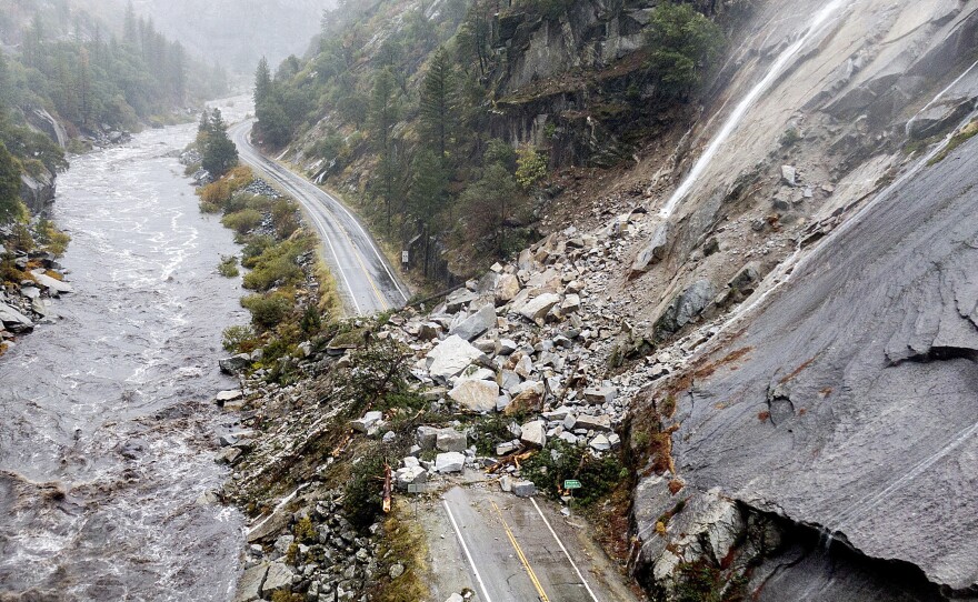
On Sunday, about 150 miles to the north, the California Highway Patrol closed a stretch of State Route 70 in Butte and Plumas counties because of multiple landslides within the massive Dixie Fire burn scar.
In California's Colusa and Yolo counties, state highways 16 and 20 were shut for several miles due to mudslides, the state Department of Transportation said.
Flooding causes evacuations across Northern California

Flooding was reported across the San Francisco Bay Area, closing streets in Berkeley, inundating Oakland's Bay Bridge toll plaza and overflowing rivers in Napa and Sonoma counties. The flooding brought down power poles as well.
By Sunday morning, Mount Tamalpais just north of San Francisco had recorded a half foot of rainfall during the previous 12 hours, the weather service said.
"Some of our higher elevation locations could see 6, 7, 8 inches of rain before we're all said and done," weather service meteorologist Sean Miller said.
Officials urged residents to stay off the roads.
"We have already had several collisions this morning for vehicles hydroplaning, numerous trees falling, and several roadways that are experiencing flooding," the highway patrol's office in Oroville tweeted on Sunday. "If you can stay home and off the roads today, please do. If you are out on the roads, please use extreme caution."
In San Francisco, residents that live in three buildings on 9th Avenue of the city were forced to evacuate their home due to the threats posed by a downed 100 foot tree.
Elsewhere, Santa Barbara County officials ordered residents living west of Las Flores Canyon, east of Mariposa Reina and south of West Camino Cielo to evacuate by noon on Sunday. Those residents lived around the Alisal Fire burn scar.
Emergency responders were concerned heavy rain expected through Monday could trigger debris flows and flash floods that can trap residents in the hills of the area or sweep them away downstream.
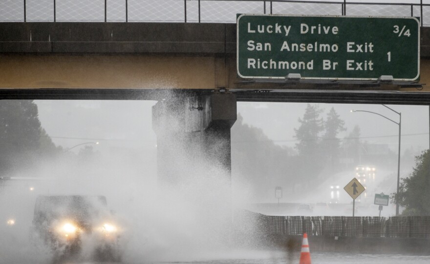
Strong winds cause destruction
The storm brought with it strong winds, with some areas experiencing 35 mph to 45 mph. On Sunday, the windiest areas, like the San Francisco International Airport, experienced winds of up to 60 mph, according to one report.
According to the San Francisco Chronicle, the strong winds were blamed for knocking over two big trucks on the Richmond-San Rafael Bridge Sunday morning.
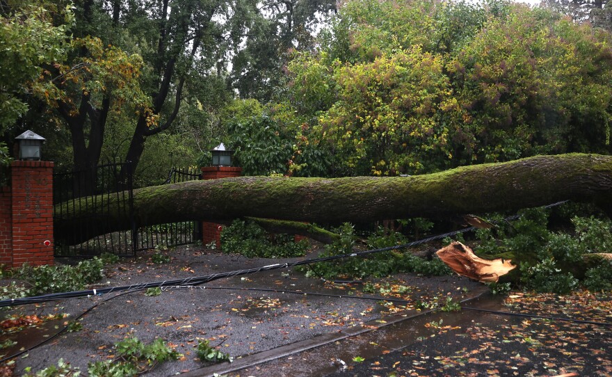
A travel trailer attached to a truck flipped over at about 10:20 a.m. and blocked the middle lane of the bridge. The winds also blew a semi-trailer truck on its side, which then landed on top of a car, the paper reported. The driver was transported to a hospital for minor injuries.
Elsewhere in San Francisco, a building's scaffolding collapsed, fire officials believe because of the wind.
Service on the city's Golden Gate Ferry was also suspended Sunday "due to sustained high winds expected to last all day," the agency shared on Twitter.
Storm conditions to spread farther north
Elevations above 9,000 feet in the Sierra Nevada could get 18 inches of snow or more from Sunday through Monday morning.
The same storm system also slammed Oregon and Washington state, causing power outages affecting tens of thousands of people.
More than 70,000 people in Washington were in the dark as of Sunday night, according to Poweroutage.us. Oregon reported just over 3,000.
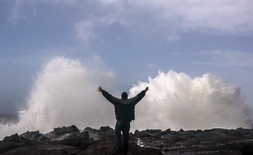
The rough conditions were blamed for the death of two people who were killed when a tree fell on a vehicle in the greater Seattle area. Eastside Fire & Rescue responded to the scene of the fatalities near Preston, Wash., which is about 20 miles east of Seattle.
Recent storms have helped contain some of the nation's largest wildfires this year. But it remains to be seen if the wet weather will make a dent in the drought that's plaguing California and the western United States. California's climate is hotter and drier now and that means the rain and snow that does fall is likely to evaporate or absorb into the soil.
California's 2021 water year, which ended Sept. 30, was the second driest on record and last year's was the fifth driest on record. Some of the state's most important reservoirs are at record low levels.
Copyright 2021 NPR. To see more, visit https://www.npr.org. 9(MDAzMjM2NDYzMDEyMzc1Njk5NjAxNzY3OQ001))


