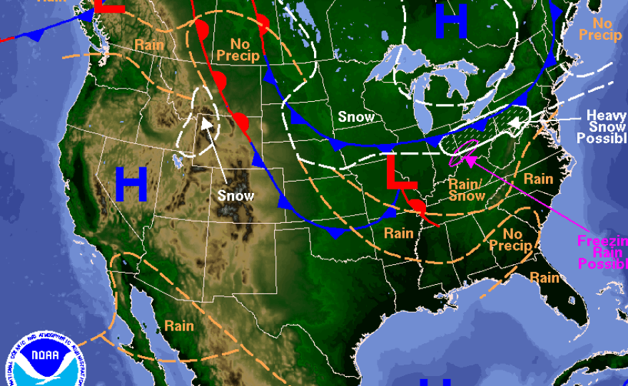
Parts of the U.S. northeast are bracing for as much as 2 feet of snow as a blizzard-like system bears down on the region.
The strong system could leave significant snowfall on the ground from Philadelphia to Maine beginning late tonight and continuing through Tuesday.
The Weather Channel runs down the basics:
-- Moderate-to-heavy snow likely from portions of the coastal Mid-Atlantic (New Jersey, eastern Pennsylvania) to New England.-- Peak impacts late Monday through Tuesday. -- Accumulations of 1 to 2 feet likely (locally 2+ feet possible). -- Blizzard or near-blizzard conditions will make travel impossible. -- Flight cancellations, major delays and possible airport closures late Monday through Tuesday. -- Damaging wind gusts and coastal flooding also expected. -- Lighter snowfall from the Midwest to the central Appalachians and Mid-Atlantic Sunday into early Monday.
The Associated Press quotes meteorologist Patrick Maloit as saying that areas east of New York City could receive more than a foot if the storm develops as forecast, adding it's still "a big if."
According to the AP:
"The storm, which brewed late Saturday around the Iowa-Minnesota line, is likely to track down into the central Appalachians and then very slowly traverse its way through the Northeast states and reach the Gulf of Maine late Tuesday night, he said. The slow movement of the storm, he said, could help produce quite a bit of snowfall and blizzard-like or blizzard conditions: at least three hours of wind gusts of 35 mph or greater and visibility of less than a quarter of a mile because of snow or blowing snow. "The storm could stall before it tracks out to sea, bringing high wind, heavy precipitation and the potential for coastal flooding, the National Weather Service said. It would be the second wallop for the Northeast after what happened Saturday, when a storm crawling up the East Coast left a slushy, snowy coating from Pennsylvania to New England."
Copyright 2015 NPR. To see more, visit http://www.npr.org/.


