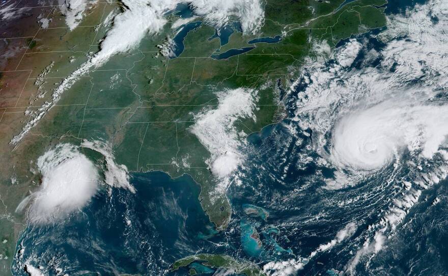
Heavy rains are triggering flash floods in eastern Texas as Tropical Depression Imelda draws nearer in the Gulf of Mexico — one of several large storms that forecasters are watching closely Wednesday. In the Atlantic, Bermuda is under a hurricane warning as Hurricane Humberto nears the island as a Category 3 storm.
Imelda was briefly a tropical storm after forming in the Gulf. Despite weakening into a tropical depression Tuesday night, the storm is still expected to bring an additional 5 to 10 inches of rainfall to Houston, Galveston and other parts of eastern Texas through Friday, with isolated totals of 20 to 25 inches possible.
Imelda is bringing "heavy rains and significant flash flooding" that are expected to spread inland over the next couple of days, according to the National Weather Service. The center of the storm is currently some 65 miles north of Houston — but it's creeping along at 5 mph, raising the chances of dangerous floods.
Flash flood watches are currently in place for southeast Texas and the far southwestern corner of Louisiana, the NWS says. Sections of Louisiana will see 4 to 8 inches of rain, with isolated totals of up to 10 inches possible.
Out in the Atlantic Ocean, Humberto grew larger and more powerful Wednesday morning. Its core "is expected to pass just to the northwest and north of Bermuda later tonight," the National Hurricane Center says.
The storm has maximum sustained winds of nearly 120 mph, with higher gusts. Humberto is projecting hurricane-force winds for up to 105 miles from its center, with tropical storm-force winds extending for nearly 200 miles.
The Bermuda Weather Service is warning residents to prepare for squalls, gale-force winds and heavy rain, along with powerful thunderstorms. Humberto is moving east-northeast at nearly 16 mph, the NHC says.
Far to the east in the open Atlantic, Tropical Storm Jerry is predicted to become a hurricane Thursday night, the NHC says. Jerry would then approach the northern Leeward Islands sometime Friday — but forecasters say it's too early to tell if any islands might face dangerous conditions. The storm's current five-day cone predicts it will stay on a track to the north of Antigua and Barbuda.
As of 11 a.m. ET Wednesday, Jerry's maximum sustained winds had risen to nearly 50 mph. The NHC forecast predicts that the storm's winds will remain at the Category 1 level over the next five days.
In the Pacific Ocean, the NHC is monitoring Tropical Storm Lorena — which it predicts will become a hurricane as it nears the coast of southwestern Mexico late Wednesday and overnight. Mexican authorities have issued a hurricane warning for coastal areas from Punta San Telmo to Cabo Corrientes.
The storm had 65 mph maximum sustained winds as of 11 a.m. ET.
"Lorena is forecast to cause heavy rain over portions of the Mexican states of Guerrero, Michoacan, Colima and Jalisco during the next few days," the NHC says. "This rainfall may produce life-threatening flash flooding and mudslides."
Copyright 2019 NPR. To see more, visit https://www.npr.org.


