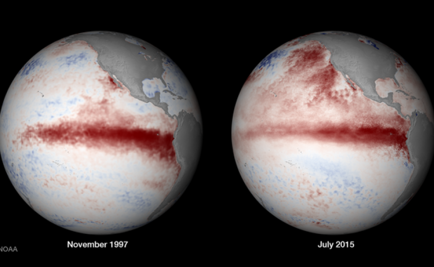
Recently released satellite photos of the western pacific show the ocean is looking a lot like it did during the last major El Niño in 1997.
The images show a wide band of warmer than usual water sweeping across the central Pacific ocean. When the latest pictures are compared to historical photos from 1997, those images look almost the same.
David Pierce is a climate researcher at the Scripps Institution of Oceanography.
He said the newest photos also show warmer than usual water off the West Coast, something researchers are referring to as the blob.
"It is mostly a response to weather, rather than a forcing of weather. However, if you're right along the coast, as are people here in San Diego, then it can have some mild effects if you are quite near the water," Pierce said.
The warmer water could shift the storm track and in turn increase chances of bringing more rain to the southwest, Pierce said.
"El Niño usually increases precipitation in the southwest U.S. by about 20 to 30 percent, on average. When you have a stronger El Niño it's a better relationship. But it's always this 'probabilistic' thing. It is weighting the dice. We're not guaranteed rain unfortunately," Pierce said.
If the rain does come, it could be a boost to the Sierra Nevada snowpack and the Colorado River basin. Both areas supply water to San Diego.


