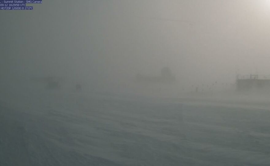
Just a month after rainfall was recorded for the first time ever at Greenland's highest point, the island is expecting up to four feet of snow from the remnants of Hurricane Larry — the rare tropical storm to stay intact so far north.
Hurricane-force gusts topped 100 miles per hour at Kulusuk Airport near Greenland's southeast coast. At Tasiilaq, the largest town in the region, sustained winds reached 55 miles per hour, with gusts of over 90.
The snow reached blizzard conditions at Summit Camp, a weather station at the island's highest point more than 10,000 feet above sea level, with winds and snow so heavy that visibility was minimal.
"Ex-hurricane Larry is still haunting us," the Danish Meteorological Institute wrote.
The winds and precipitation — rain in some places along the coast, snow further inland — were expected to last into Monday.
The "post-tropical cyclone," the longest-lasting of this year's Atlantic hurricane season, neared Greenland a day after making landfall in Newfoundland, Canada, as a Category 1 storm, where it blew down trees and knocked out power for tens of thousands of residents.
Sunday's extreme winds and precipitation come as Greenland's extremely warm summer has come to a close.
Multiple major melts were recorded this year, two in July and a third in August. Though melt levels did not reach ice melt totals seen in 2012 and 2019, the total melt across the island in 2021 has been much higher than average totals from the last several decades.
"Any way you cut it, this is going to be one for the record books," said Josh Willis, a lead scientist with NASA's Oceans Melting Greenland mission, speaking to NPR's Here & Now.
At the Summit weather station, perched more than 10,000 feet above sea level, it is extremely rare to record even a temperature above freezing, let alone rain.
So the rain in August — not a single sprinkle, but a steady drizzle that lasted for several hours — was the first ever recorded since the weather station opened in the 1980s. This summer marked just the fourth ever melt recorded there, three of which have come in the last decade.
"There were giant lakes, hundreds of tiny rivers carrying this water around," said Willis, who flew over the affected area shortly after the melt last month. "Our captain of the airplane, who's been flying over Greenland for a quarter of a century, remarked he'd never seen anything this big, this high on the plateau this late in the year."
Warmer temperatures and longer-lasting hurricanes are both symptoms of climate change.
Greenland's ice sheet, the largest in the northern hemisphere, saw a 30% increase in summer melt between 1979 and 2006. Higher elevations have reported more snowfall, but not enough to offset the melt, according to the National Snow & Ice Data Center.
"Greenland's melted enough in the last 15 years or so — 5 trillion tons of ice — enough to raise global sea levels by almost an inch, a big fraction of an inch," Willis said. "What's happening on this island is really affecting the entire planet."
The ice sheet is so large — 2 miles thick in some places — that if the entire thing melted, sea levels across the globe would rise by about 20 feet.
Though a complete melt may seem to be a long way off, Willis said a tipping point from which there is no return could come soon.
"We're pushing our climate towards the edge of a cliff, but we can't see how close we are to the edge. And these trip wires, like runaway ice melt, are things that we are pretty sure exist, but we just don't know when we're going to hit them," he said. "That's the scariest part."
Copyright 2021 NPR. To see more, visit https://www.npr.org.


